Damariscotta River Fog Bank

We'll soon be offering photos here for sale. Imagine having a 6' high-resolution print of this hanging on your wall!
You can click on these for larger gallery view (all photos on this page are lower-resolution JPEG exports to keep the size manageable; the full-resolution JPEG of the panorama is 97 MB!).
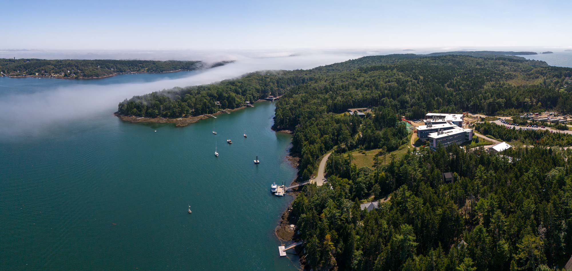
Steve here. We often get fog banks rolling up the Damariscotta River on sunny days, coming in from the open ocean off the Boothbay Harbor area of Midcoast Maine. We've even gotten pinned in a boat upriver by a dense bank that completely cut off the mouth with less than 50 feet of visibility.
When I saw this one creeping up the river earlier this week, I rushed out with the drone and got several shots from about 400 feet over the river.
That included 6 shots rotating in place from right to left that I merged into the panorama above with Lightroom. It presents a nearly 270 degree view. The river mouth is to the south.
What a result! I was amazed to see the heavy fog literally pouring in from the ocean. Then to see the flow trailing way up the river. Then the distant fog past Linekin Bay on the upper right, with Boothbay Harbor just visible in the rightmost background. And then in the background center and left, the same heavy fog pouring over Muscongus Bay.
It's utterly fascinating to see a nearly 5 mile trail of fog flowing like a wisp of smoke up the river.
Note that the panoramic process, with the camera rotating from a single viewpoint, produces a curved view of the fog. Physically, it actually followed a straight path up the river.
Below are the individual constituent photos, followed by some smaller panoramas as I experimented with merging more and more of them. Each one offers different details and aesthetic effect. You can also see how the fog follows a straight path through each separate photo, but at a different angle relative to the camera, so merging them produces the curved path.
First, facing southwest, East Boothbay to Linekin Bay, with a sliver of Boothbay Harbor just visible in the upper right.

Second, turning southward, Bigelow Laboratory for Ocean Sciences in East Boothbay. That's open ocean out past the islands in the background.

Third, turning eastward up from the south, showing the river mouth.

Fourth, southeast across to Christmas Cove, Muscongus Bay in the background.

Fifth, turning east and north, the tendril of fog creeping up past Bristol, with a better view of the fog rolling over Muscongus Bay in the background. Notice the lobster pots visible in the sunlight in the foreground!

Sixth, facing north, the tail end of the fog.

The smaller panoramas, starting from merging the second and third photos and adding progressively more.


Finally, a couple of bonus shots, slightly different views of the main cloud.


Comments
Post a Comment